The streets are closed to cars and open to YOU – get out and enjoy!!
Get out and connect with your community and urban environment in a transformative way!
Sunday Streets (also called “Open Streets”) closes streets to automobile traffic for a day so that people may use the space for other physical and social activities. The streets become parks as people replace car traffic. People walk, bike, skate and dance and play. Everyone from businesses and community organizations to musicians and artists use the space creatively, engaging the public and providing spontaneity and discovery. This temporary public space inspires creativity and change for the better, on that day – and beyond.
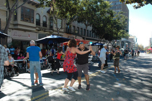
Dancing in the Streets in Berkeley! All photos courtesy Amy Smolens
The first Sunday Streets Berkeley was on October 14, 2012. More than 42,000 people came to Shattuck Ave to stroll, skate, cycle, dance, play in the street. People came from all over the Bay Area to experience Berkeley anew. Local Berkeley businesses reported a 30-50% increase in sales on the day of the event. The first-ever Sunday Streets Berkeley was by all measures a great success.
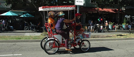
Ride on over!
Previous routes have been expanded – Sunday Streets now runs the length of Shattuck from Rose to Channing, and continues on Durant to Telegraph.
Here’s an interactive map of Sunday Streets activities.
The planned I-80 Gilman Interchange Project will improve travel for all users of that area, including people who bike to the Bates Fields, Berkeley Marina and south on the Bay Trail.
CalTrans has adopted a Negative Declaration for the project, which is excellent news.
This page has additional information on the entire project and plan.
This Open Open Forum Hearing will give you an opportunity to show your support for this project, or discuss improvements that might help Active Transportation access and safety.
If you can’t attend but would like to voice support, please send an email to Zachary.Gifford@dot.ca.gov
Hikes range from strenuous to easy.
**CHECK SCHEDULE FOR SPECIFIC EVENT TIMES!! Download the full schedule and map to events at https://ectrailtrekkers.wordpress.com/hillside-festival-2019/
Locations vary, including
Motorcycle Hill, where Navellier and Blake streets meet
Madera Elementary School, 8500 Madera Dr.
Madera Circle Entry, between 1540 and 1560 Madera Circle
Regency Gateway, at northern end of Regency Court
King Court Gateway, at end of King Court.
Schmidt Lane Trailhead, near the end of Schmidt Lane, west of the Recycling Center
SO CHECK SCHEDULE FOR LOCATIONS
Sponsored by El Cerrito Trail Trekkers and El Cerrito’s Environmental Quality Committee. Free.
The festival is free but maintaining and restoring the Hillside is not. Please make a tax deductible donation to this effort with a check to “ECCF,” with “Hillside Restoration” in the message line. ECCF is El Cerrito Community Foundation, our fiscal agent. Send to Pam Austin, 834 Kearney St., EC 94530.
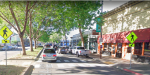 Join Walk Bike Berkeley members, District 2 Berkeley City Council Candidate Terry Taplin, Transportation Commissioners, and others to discuss road safety challenges and opportunities on San Pablo Avenue.
Remember, what is done in Berkeley will have an impact on Albany’s stretch of San Pablo!
Meet at Dwight & San Pablo, walk to University Ave (7 blocks)
RSVP: info@walkbikeberkeley.org
WHY SAN PABLO?
-
San Pablo from Dwight to University is the highest priority street segment to fix in Berkeley’s draft Pedestrian Plan, based on safety and equity needs
-
Just 14% of Berkeley’s street miles account for 93% of pedestrian fatalities & severe injuries
-
Berkeley’s busy, arterial streets are the most dangerous for people walking and biking
-
Alameda County, including Albany, is planning the future of the San Pablo Avenue Corridor
IF YOU WANT TO WALK OR BIKE TO THE START FROM ALBANY, PLEASE LEAVE A COMMENT AND PROPOSED STARTING TIME & PLACE IN “COMMENTS”