There are lots of items on the agenda that affect cyclists and pedestrians here in Albany.
Those include the following:
*7-1, City Council Strategic Planning Follow Up
Part of what City Council Members recommended in its recent planning session was an emphasis on parks, including the long-awaited Pierce Street Park, and a more bikeable and walkable Albany.
Please speak in support of these plans and concepts!
*7-2, Update on “Complete Streets” planning for Buchanan Street and San Pablo Avenue to improve safety for walking, biking, and other modes of travel. The Staff recommendation is for Council to provide direction to staff and the Traffic and Safety Commission.
Show up and speak to let Council hear that a more bike and pedestrian friendly San Pablo Avenue should be a priority and a reality!
It may also be a good time to speak about your vision for Bike Boulevards on Kains and Adams, making up for the fact that many people will not feel safe riding on San Pablo in the sections without bike lanes.
*8-1, Albany Wayfinding Plan for Bicyclists and Pedestrians
Whenever I ride around Berkeley I marvel at the signage that directs me to the best and safest roads to cycle. I am also fully convinced that motorists on or crossing roads with signage for bicyclists are more courteous to their two-wheeled friends sharing the road.
Show up and tell Council that we all need wayfinding signage for our convenience and safety!
If you can’t attend, please consider writing a brief letter in support of any of these items to cityhall@albanyca.org requesting specifically that your letter be sent to all the City Council Members.
Thanks! Feel free to email the Discussion List or any of the Core Group with any questions or thoughts.
Have you noticed that Albany is small and you often end up in El Cerrito and Berkeley? Here’s a good chance to give some input to our neighbor to the north!
Come help design five urban greening projects to improve the environmental sustainability, economic vitality and community cohesion of the City of El Cerrito! The Community Charrette is an interactive design workshop that allows you to meet with neighbors and other community members to envision the future of five pilot projects: 1) Fairmount Park, 2) Hillside Natural Area, 3) Former Portola Middle School Site, 4) Lower Fairmount Ave from Carlson Blvd to San Pablo Ave, and 5) Bay Trail (Blue Belt) to Wildcat Canyon (Green Belt) Connections. These sites have been selected from a larger list of Urban Greening opportunities for their strategic location, multiple community and environmental benefits, and pilot potential. With feedback gathered at the Charrette, the City’s Urban Greening consultants will prepare conceptual designs to be included in the Urban Greening Plan.
Like some of the things AS&R has been able to accomplish in Albany? Suggest them to the City of El Cerrito. Like what you see in EC? Suggest them here in Albany!
9:30 am Welcome and Plan Overview
10:30 am Breakout Design Sessions
12:00 pm Lunch
12:30 pm Report Back
1:25 pm Next Steps
1:30 pm Close
For more information, please visit the website at www.ElCerritoUrbanGreening.org
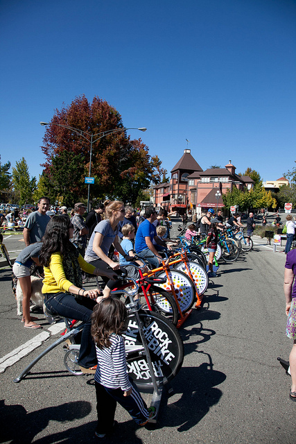
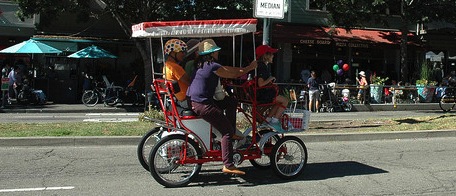 If you’ve read about Ciclovías and Open Streets events all over the world, here’s one right in your
 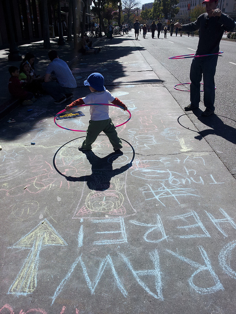 backyard.
On Sunday, October 18th from 11am-4pm, Shattuck Avenue between Rose and Haste will be closed to motor vehicles so you can bike, skate, wheelchair, scooter and walk to your heart’s content!
 There will be plenty of activities for your and your family to enjoy, or just wander along the street with no worries about cars, grab a bite at an outdoor table and hang out!
For more information, go to www.sundaystreetsberkeley.org .
Hope to see you there!

Come on down and learn how to ride a bike more safely – and have more fun!
Do you, a friend or family member want to ride your bike more but don’t feel confident enough?
Here’s a FREE bicycle skills class RIGHT IN OUR BACKYARD, courtesy of Bike East Bay!
In addition to the regular first-Mondays classes at UC Berkeley, they have now set up a free Urban Cycling 101 Day 1 classroom workshop for adults and teens at the Albany Library/Community Center on Saturday, July 16th, from 1-3pm. Complete details and registrations are available here.
The class is FREE but it’s mandatory to register here.
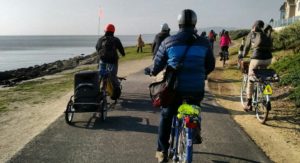
Help ensure that Albany’s segment of the Bay Trail will be completed, and safe & fun for all!
After a group of Albany residents, including fellow Strollers & Rollers, pointed out improvements that should be made to our Waterfront, there will be a chance to see the plans and give input on the Albany Bay Trail and beach project, officially known as the Albany Beach Restoration and Public Access Project.
Let’s make sure that OUR Waterfront is optimized for people who want to bike, walk, stroll and roll. There is a lot of car parking, but not nearly as much attention paid to parking for bicycles.
Note: a quorum of the City Council and/or an advisory body to the City Council may be present at this public meeting.
Here is the site plan
And the existing conditions map
And the complete packet from the most recent public meeting (April 17), which was at the San Francisco Bay Conservation and Development Commission Design Review Board. This packet has cross-sections and more detailed plans and a staff report.
Albany resident and landscape architect Hugo Larman drafted this updated plan based on community input, which expands the beach area, adds bike racks and moves car parking near existing parking.
EIR and other info from EBRPD (scroll down to where is says “Albany Beach Habitat Restoration and Public Access Project.”)
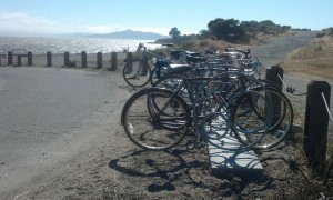
These racks that AS&R bought are perfectly situated for folks who want to enjoy the beach, a hike or just enjoy the beautiful view, but they are lonely! We need more “there” at the Waterfront, and more bike racks near other destinations.
AS&R member Dan Johnson prepared comments and alternative plans . After further discussion, Dan & others believe that the location for parking might not be feasible. However his diagram about the amount of paving is relevant.
While not a part of EBRPD’s plan, the Albany Waterfront Committee’s Cove Enhancement Plan should be completed by the City of Albany and taken into account by EBRPD for a comprehensive plan at the entire waterfront. The only reason it was not completed in 2012 was because EBRPD requested the City hold off because of upcoming construction. That reason is long past.
In response to recent community comments, the designers are making efforts to reduce the large amount of pavement for the vehicle driveway and turnaround to leave more open space for recreation at the south end of the site. However, a number of us believe that it would be more functional and would preserve more open space (as well as reduce bicycle-pedestrian conflicts) to locate the parking near the existing parking, on the north side of Buchanan St., which would eliminate the need for the long driveway. However, this area is City-owned and outside the EBRPD project area.

The streets are closed to cars and open to YOU – get out and enjoy!!
Get out and connect with your community and urban environment in a transformative way!
Sunday Streets (also called “Open Streets”) closes streets to automobile traffic for a day so that people may use the space for other physical and social activities. The streets become parks as people replace car traffic. People walk, bike, skate and dance and play. Everyone from businesses and community organizations to musicians and artists use the space creatively, engaging the public and providing spontaneity and discovery. This temporary public space inspires creativity and change for the better, on that day – and beyond.
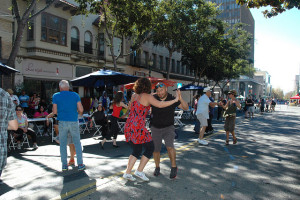
Dancing in the Streets in Berkeley! All photos courtesy Amy Smolens
The first Sunday Streets Berkeley was on October 14, 2012. More than 42,000 people came to Shattuck Ave to stroll, skate, cycle, dance, play in the street. People came from all over the Bay Area to experience Berkeley anew. Local Berkeley businesses reported a 30-50% increase in sales on the day of the event. The first-ever Sunday Streets Berkeley was by all measures a great success.
Ride on over!
Previous routes have been expanded – Sunday Streets now runs the length of Shattuck from Rose to Channing, and continues on Durant to Telegraph.
Here’s an interactive map of Sunday Streets activities.