What’s important to you to communicate to the Albany Police Department?
Here’s an opportunity to give them your input! Make plans to attend their Community Work Session and tell them what’s important to you as an Albany resident or visitor. They want to clearly identify resident’s priorities for the next 3-5 years and plan to incorporate those priorities into their strategic planning process. Your opinion matters… so let them know what matters to you at this meeting!
RSVPs are requested but not required: policeplan@albanyca.org
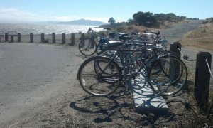
These racks that AS&R bought are perfectly situated for folks who want to enjoy the beach, a hike or just enjoy the beautiful view.
Help give input to make the Waterfront even more enjoyable!
The Bay Conservation & Development Commission will hold a Hearing on the Albany Beach Project.
Albany Beach Restoration & Public Access Project (first review) is the first actual agenda item of the meeting.
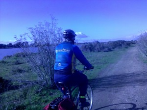
Won’t it be nice when we have a Bay Trail Connection through Albany?
The Design Review Board will review the design by the East Bay Regional Parks District, Questa Engineering, and 2M Associates for the Albany Beach Restoration and Public Access Project in the Cities of Albany and Berkeley, adjacent to Golden Gate Fields. The project would enhance the existing beach and dunes and would create approximately 4,765 linear feet of new Bay Trail, overlooks, and a 20-space parking lot.
Link to Meeting Materials which includes exhibits for the above which is Item 4 (but the first actual agenda item) on the Tentative Agenda.
Help ensure that Albany’s segment of the Bay Trail will be completed, and safe & fun for all!
After a group of Albany residents, including fellow Strollers & Rollers, pointed out improvements that should be made to our Waterfront, there will be a chance to see the plans and give input on the Albany Bay Trail and beach project, officially known as the Albany Beach Restoration and Public Access Project.
Let’s make sure that OUR Waterfront is optimized for people who want to bike, walk, stroll and roll. There is a lot of car parking, but not nearly as much attention paid to parking for bicycles.
Note: a quorum of the City Council and/or an advisory body to the City Council may be present at this public meeting.
Here is the site plan
And the existing conditions map
And the complete packet from the most recent public meeting (April 17), which was at the San Francisco Bay Conservation and Development Commission Design Review Board. This packet has cross-sections and more detailed plans and a staff report.
Albany resident and landscape architect Hugo Larman drafted this updated plan based on community input, which expands the beach area, adds bike racks and moves car parking near existing parking.
EIR and other info from EBRPD (scroll down to where is says “Albany Beach Habitat Restoration and Public Access Project.”)
These racks that AS&R bought are perfectly situated for folks who want to enjoy the beach, a hike or just enjoy the beautiful view, but they are lonely! We need more “there” at the Waterfront, and more bike racks near other destinations.
AS&R member Dan Johnson prepared comments and alternative plans . After further discussion, Dan & others believe that the location for parking might not be feasible. However his diagram about the amount of paving is relevant.
While not a part of EBRPD’s plan, the Albany Waterfront Committee’s Cove Enhancement Plan should be completed by the City of Albany and taken into account by EBRPD for a comprehensive plan at the entire waterfront. The only reason it was not completed in 2012 was because EBRPD requested the City hold off because of upcoming construction. That reason is long past.
In response to recent community comments, the designers are making efforts to reduce the large amount of pavement for the vehicle driveway and turnaround to leave more open space for recreation at the south end of the site. However, a number of us believe that it would be more functional and would preserve more open space (as well as reduce bicycle-pedestrian conflicts) to locate the parking near the existing parking, on the north side of Buchanan St., which would eliminate the need for the long driveway. However, this area is City-owned and outside the EBRPD project area.
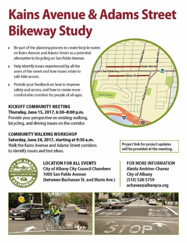
Live on Kains or Adams?
Go to the YMCA?
Do you and your family want to AVOID bicycling on San Pablo Avenue?
Then you’ll be interested in this opportunity for public input on the Kains and Adams Bicycle Boulevards!
I’m sure many of you have ridden the Bicycle Boulevards in Berkeley and seen how more comfortable it is to ride Milvia instead of MLK or Shattuck, Russell instead of Ashby, and 9th instead of San Pablo.
If not, here is info on Berkeley’s Bicycle Boulevard system.
Now imagine if people could avoid San Pablo until a half-block from their destination by riding Kains and Adams
More information is below and a link to the site walk on June 24th is here.
Live on Kains or Adams?
Go to the YMCA?
Do you and your family want to AVOID bicycling on San Pablo Avenue?
Then you’ll be interested in this site walk focusing on the Kains and Adams Bicycle Boulevard projects.
Walk, talk, and find out about what’s possible to make these streets safer for bicyclists!
I’m sure many of you have ridden the Bicycle Boulevards in Berkeley and seen how more comfortable it is to ride Milvia instead of MLK or Shattuck, Russell instead of Ashby, and 9th instead of San Pablo.
If not, here is info on Berkeley’s Bicycle Boulevard system.
Now imagine if people could avoid San Pablo until a half-block from their destination by riding Kains and Adams!
This is the City page for this event.
More information is below and a link to the Community Meeting on June 15th is here.
The crucial Kains/Adams Bicycle Blvd project will be on the agenda of October’s Traffic & Safety Commission Meeting.
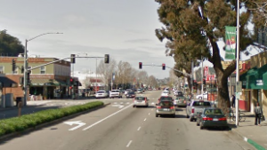
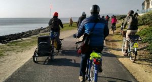
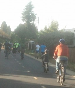
WOULD YOU RATHER BIKE ON THIS…..
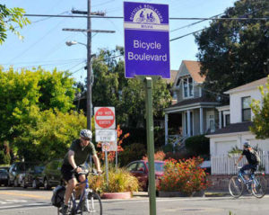
OR THIS?? SPEAK UP TO MAKE THIS A REALITY IN ALBANY!
Considerable local opposition has arisen, and we are in danger of missing out on these facilities. If you and your family would use either of these Bicycle Boulevards because you want to AVOID bicycling on San Pablo Avenue, live on Kains or Adams, go to the YMCA, please act!
How? 1) Send a letter of support to Aleida Andrino-Chavez , requesting that she forwards it to the Traffic & Safety Commission, and cc or bcc me, Amy Smolens , so I can track support, which is important.
2) Attend this meeting and tell the Traffic & Safety Commission that you and your family need these Bicycle Boulevards as they decide from among the various traffic calming and Bicycle Boulevard options for our neighborhoods.
Engage with City staff, consultants, and your neighbors in community planning for improving pedestrian and bicyclist.
I’m sure many of you have ridden the Bicycle Boulevards in Berkeley and seen how more comfortable it is to ride Milvia instead of MLK or Shattuck, Russell instead of Ashby, and 9th instead of San Pablo.
If not, here is info on Berkeley’s Bicycle Boulevard system.
Now imagine if people could avoid San Pablo until a half-block from their destination by riding Kains and Adams!
This is the FINAL COMMUNITY MEETING before Traffic & Safety Commission makes its recommendations to City Council so your attendance is important!!
This was the consultants’ presentation at the meeting on October 4th.
The monthly Traffic & Safety Commission Meeting, the Fourth Thursday of every month, is a great place to make your ideas known, find out about the transportation issues and projects in Albany, and help improve things for cyclists and pedestrians in and around our town.
This is a map and chart of the regional bicycle route from Oakland to Richmond – Albany is the only gap in a 12+ mile North-South bike route.
Here is the meeting agenda. Kains/Adams is the second item on the agenda, and the first item is related – North Albany traffic calming, which included Kains Ave near El Cerrito Plaza.
Come on down – thanks!

Ride on down to Everest Kitchen to enjoy a special Happy Hour menu and chat about biking and walking – plenty of bike parking!
Come and talk about walking and cycling in Albany – specifically, the Kains/Adams Bikeways project, while eating delicious Nepali & Indian food! All are invited.

Sanjiv says “come on down! 15% discount for you!”
This special Happy Hour takes place right before tonight’s City Council Meeting so we can discuss what’s on the agenda – the Kains/Adams Bikeway projects and other items beforehand…while eating delicious dinner or snacks.
Everest Kitchen is a family owned restaurant and Sanjiv offers us 15% off their menu, including drinks, and yes, they have plenty of bike parking! It’s also an opportunity to ask about what the city is up to and what our stance on issues is, and to meet others who are interested in issues related to human-scale transit/active transit.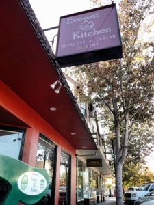
Have something you want to talk or ask about? Put it in the “comments” section below! Hope to see you there!
The crucial Kains/Adams Bicycle Blvd project is on the agenda of December 4th’s City Council Meeting so we need your support!
OR THIS?? SPEAK UP TO MAKE THIS A REALITY IN ALBANY!
WOULD YOU RATHER BIKE ON THIS…..
In October, Albany’s Traffic & Safety Commission passed a plan that included two-way bicycle boulevards with semi-closures, so there will be no additional motor vehicle traffic at all – just safe two-way passage by bicyclists wanting to avoid San Pablo Avenue.
This is Option 3, which the Traffic & Safety Commission chose, without moving any stop signs nor utilizing traffic circles.
There was some local opposition by residents who didn’t see any need for bicycle facilities in Albany but YOU and your neighbors showed up and wrote letters. Let’s make sure that happens at this meeting, too, so bicyclists can ride safely in our town! If you and your family would use either of these Bicycle Boulevards because you want to AVOID bicycling on San Pablo Avenue, live on Kains or Adams, go to the YMCA, please act!
HOW CAN YOU HELP?
1) Send a letter of support to citycouncil@albanyca.org , requesting that your email is forwarded to all City Council members, and cc or bcc me, Amy Smolens , so I can track support, which is important. Even a brief “I support the Kains and Adams Bicycle Boulevards and my family and I would ride on them…”
“My family and I don’t feel safe riding on San Pablo so please approve the Kains and Adams Bicycle Boulevards.” Any additional detail about your support is beneficial, but just do what you can do!
2) Attend this meeting and tell City Council that you and your family need these Bicycle Boulevards that the Traffic & Safety Commission has recommended.
If you are going to go to one meeting this year, this should be it, because Kains/Adams is a central project for our bike network and it’s at risk due to local opposition. I will tell you that I have lived on Kains for 25 years and I and other neighbors support it.
You know what the Warriors say – “Strength in Numbers” so we need you to made your voice heard – thanks!
I’m sure many of you have ridden the Bicycle Boulevards in Berkeley and seen how more comfortable it is to ride Milvia instead of MLK or Shattuck, Russell instead of Ashby, and 9th instead of San Pablo.
If not, here is info on Berkeley’s Bicycle Boulevard system.
Now imagine if people could avoid San Pablo until a half-block from their destination by riding safely & comfortably on Kains and Adams!
Yes, we mind the gap!
Here are a map and chart of the REGIONAL BICYCLE ROUTE from Oakland to Richmond – Albany is the only gap in a 12+ mile North-South bike route. Yes, we “mind the gap!!”
This is the FINAL COMMUNITY MEETING before it becomes a reality, so your attendance is crucial!
Do you or your family ride on the Ohlone Greenway? Attend this meeting to work on making it safer for all.
Albany Community Action member Céline Wallace set up a meeting with 2 police departments hosted by Albany’s Mayor and Vice Mayor about safety on the Greenway. Céline organized this after her husband was held up at gunpoint on the greenway a few weeks ago, but before a Greenway shooting/murder took place in late April.
Representatives from the Albany and El Cerrito Police Departments will be on hand to provide information on crime trends and strategies affecting safe travel on the Ohlone Greenway.
Do you bike or walk on Central Avenue under I-80 to reach the places you enjoy?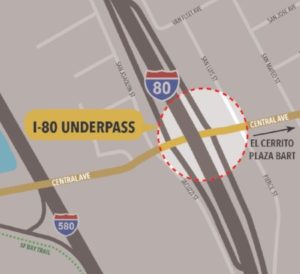
Would you like to help make it easier and safer to do so?
The Central Avenue / Interstate 80 (I-80) underpass in Richmond leads to a lot of great places—the San Francisco Bay Trail, Point Isabel Dog Park, Costco and the Richmond Marina, to name a few.
CalTrans District 4 wants your ideas on how to transform the underpass into a high-quality pedestrian and bicycle connection!

Current Underpass
Help improve your biking and walking experience in the East Bay!
Join us at the Community Workshop to share ideas on the project design. We will discuss safety features, lighting, wayfinding and other design elements.

It could look like this!!
WHO:
You! Residents, cyclists and walkers in Richmond, El Cerrito, Albany (Pierce Street and West Albany residents, that means you!!) and beyond.
For more information, go to http://www.dot.ca.gov/d4/transplanning/i-80central.html